
 Multi Function Displays
 Radars
 Fish Finders & Transducers
 GPS & Chart Plotters
 Autopilots
 Navigation
 Sonars
 Commercial
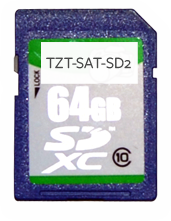
TZT-SAT-SD2
No Longer Available
MSRP: $150.00
64GB SD Card - NavNet TZtouch Satellite Photo Data for Central U.S. Rivers, Great Lakes and Gulf of Mexico
Chart RegionsUSA Central
Chart TypeSatellite Photo
Prices and Specifications Subject to Change Without Notice.
All prices shown are in USD. Prices are valid in US and Canada only.
64GB SD Card - NavNet TZtouch Satellite Photo Data for Central U.S. Rivers, Great Lakes and Gulf of Mexico
This SD Card contains NavNet TZtouch Satellite Photo data for the U.S. Central Rivers and Great Lakes and Gulf of Mexico. All of the data is collected on a single 64 GB SD card for convenience.
Optionally, you can download each of the satellite photos individually. Note that the file size for each area is approximately 1 GB; download speeds depend upon your connection speed and available bandwidth.
Areas displayed are for guidance only and do not reflect exact coverage. Click Here for a graphic view of the entire NavNet 3D/NavNet TZtouch/MaxSea TimeZero catalog for the US.