
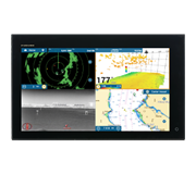
 NavNet MFDs
 Radars
 Fish Finders & Transducers
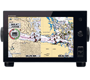 GPS & Chart Plotters
 Autopilots
 Navigation
 Sonars
 Commercial
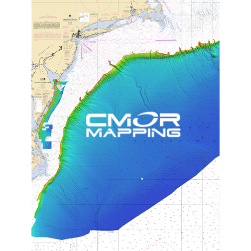
MM3-WAR-BAT-06
MSRP: $700.00
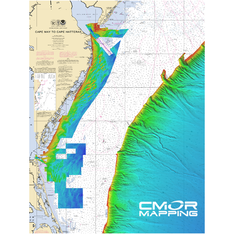
CMOR Mapping for NavNet TZtouch2 and TZtouch3 - Mid-Atlantic
Chart RegionsUSA East Coast or USA
Chart TypeCMOR
Prices and Specifications Subject to Change Without Notice.
All prices shown are in USD. Prices are valid in US and Canada only.
Available exclusively from CMOR Mapping
CMOR Charts can be purchased only through CMOR. Visit them on the web at www.cmormapping.com.
Phone: 813-563-2667 (option 1 for sales)
E-Mail: sales@cmormapping.com
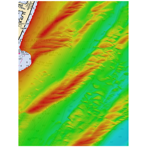
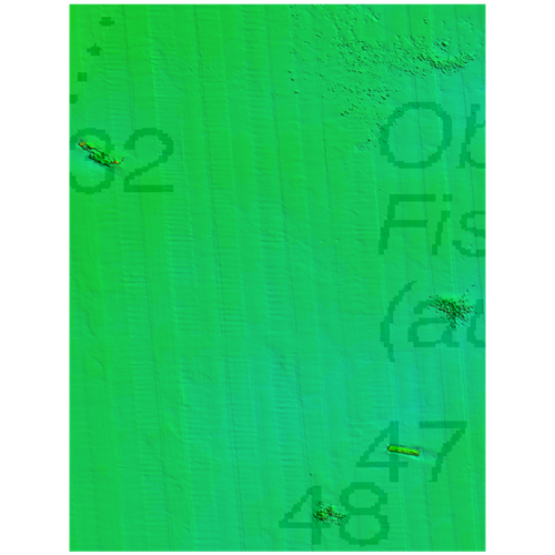
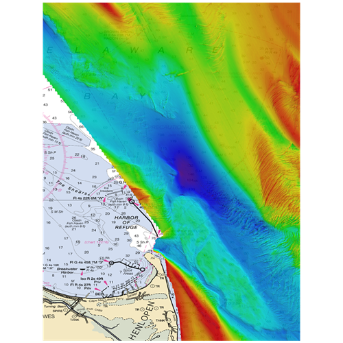
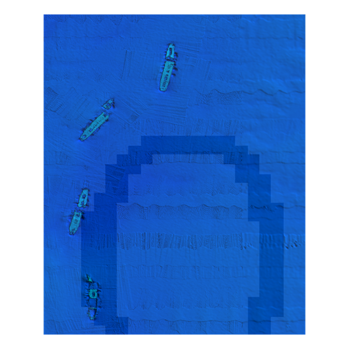
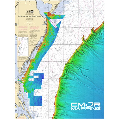
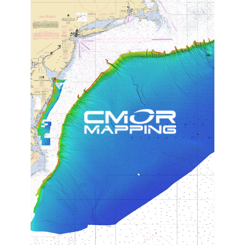
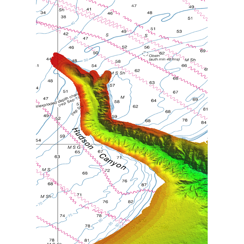
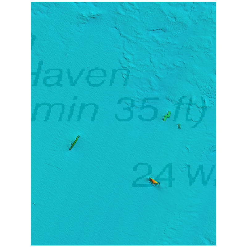
CMOR Mapping - Mid-Atlantic
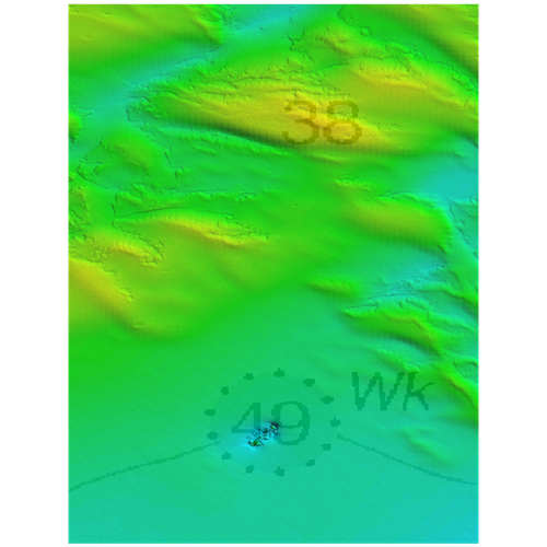
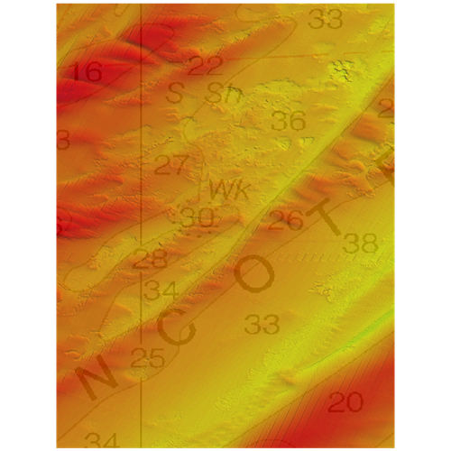
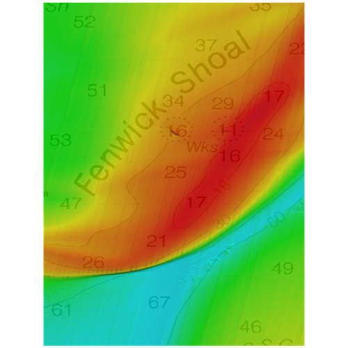
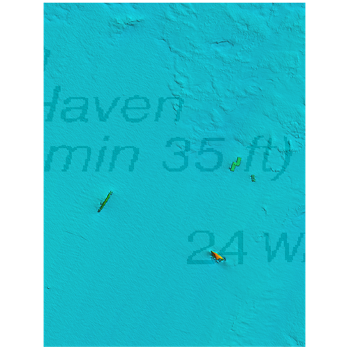
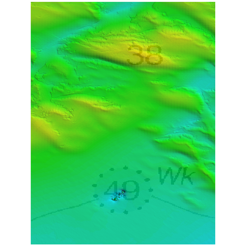
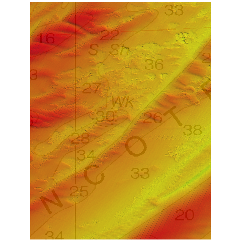
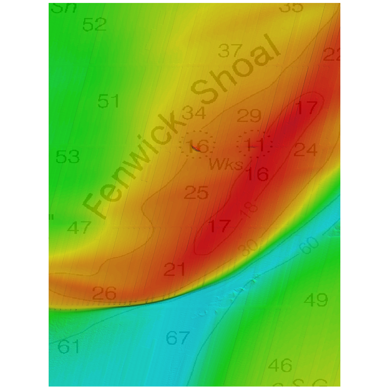
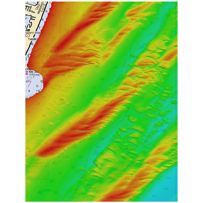
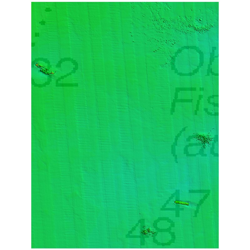
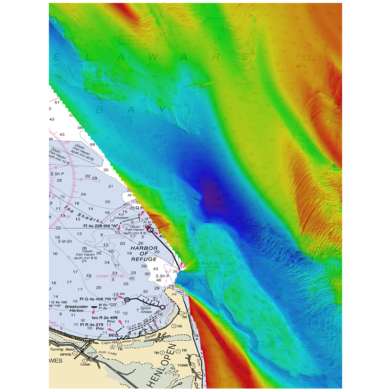
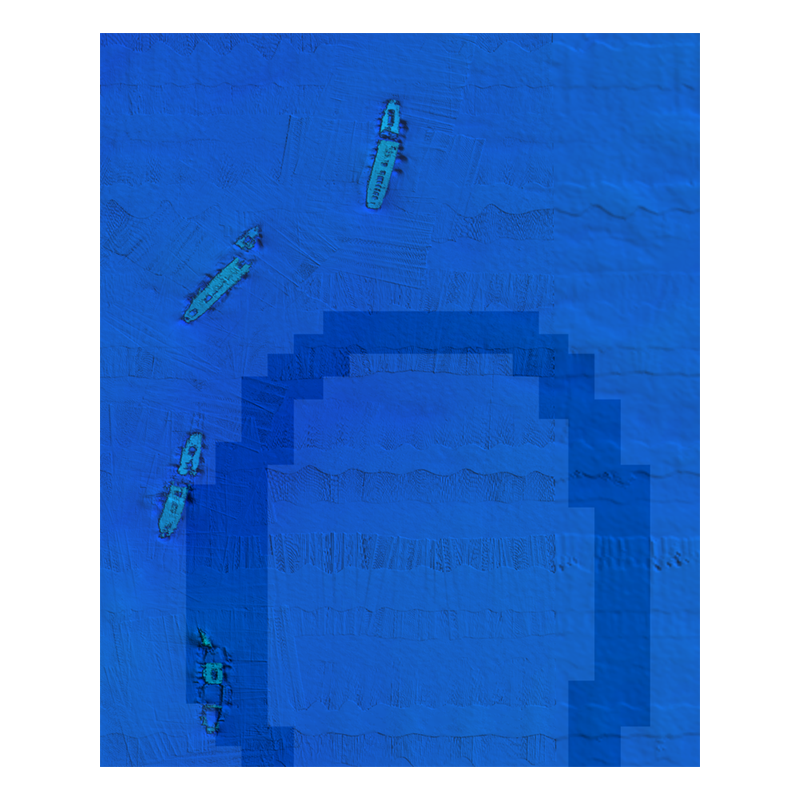
This card features some of the best fishing spots and wrecks in the Mid Atlantic with coverage starting nearshore to 20+ miles offshore, from Delaware Bay south to Virginia Beach & the NE canyons from North Carolina through Maine. Explore countless wrecks with detail like never before. Drop or troll in a variety of depths, and finally pinpoint and hook that elusive species you have been waiting to box. Whether you are looking for quick hits with our nearshore data or cruising out to catch some serious wreck fish, this is the card for you!
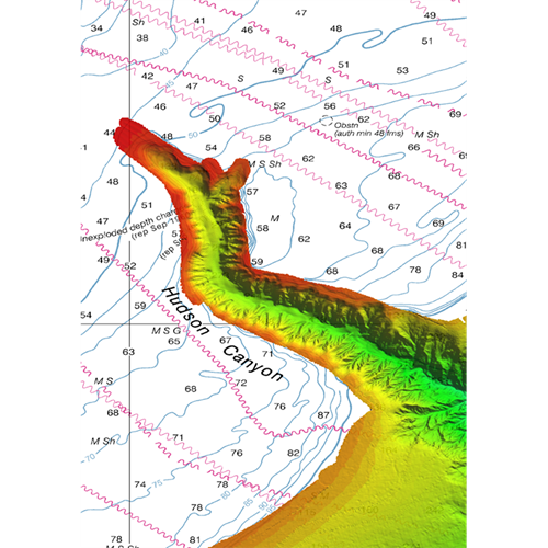
Some of the featured spots include:
- Chincoteague Shoal
- Delaware Bay
- Fenwik Shoal
- Hudson Canyon
- Ocean City Inlet
- Wrecks 30nm Due East Chesapeake Bay
This CMOR chart is compatible with all NavNet TZtouchXL, TZtouch3, and NavNet TZtouch2 MFDs with software version 6.23 and above. To purchase this chart pack for NavNet, you will need to provide your NavNet system ID to your local authorized Furuno dealer. The system ID can be located under the MyNavNet menu on your NavNet system.
Click here to download CMOR Mapping - Mid-Atlantic.
Note that you will need to purchase an unlock code from CMOR at the contact information provided at the top of this page.
NOTE: All sales of Chart Unlock Codes are final. Once an unlock code for any chart area is purchased and the code has been provided by Furuno, no refunds, credits, or exchanges are permitted.
Areas displayed are for guidance only and do not reflect exact coverage.