
 NavNet MFDs
 Radars
 Fish Finders & Transducers
 GPS & Chart Plotters
 Autopilots
 Navigation
 Sonars
 Commercial

MM3-WAR-BAT-05
MSRP: $700.00
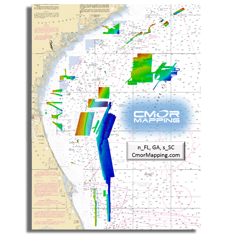
CMOR Mapping for NavNet TZtouch2 and TZtouch3 - North Florida, Georgia, and South Carolina
Chart RegionsUSA or USA East Coast
Chart TypeCMOR
Prices and Specifications Subject to Change Without Notice.
All prices shown are in USD. Prices are valid in US and Canada only.
Available exclusively from CMOR Mapping
CMOR Charts can be purchased only through CMOR. Visit them on the web at www.cmormapping.com.
Phone: 813-563-2667 (option 1 for sales)
E-Mail: sales@cmormapping.com
CMOR Mapping - North Florida, Georgia, and South Carolina
The north FLORIDA/GEORGIA/SOUTH CAROLINA chart from CMOR covers of some of the best fishing, diving, and deep dropping spots in the Atlantic Ocean. CMOR Mapping bathymetry arms you with more and better data than anybody else on the water.
The northern section of the original NEFL data starts due east of Fernandina Beach in an area locals call the R4 Navy Tower Bottom. Depths range from 100' to 2,200'. This section is 316 square miles and runs from the 30˚45.00' N line down to the 30˚36.00' N line.
The southern section of the original NEFL data starts east of Jacksonville on the 30˚29.00' N line and runs south to the 29˚53.00' N line, which is due east of St. Augustine. This section covers 941 square miles of data with depths ranging from 100' to 1,200'.
This is a must-have CMOR Card if you like to dive the secret ledges on the top of the break, bottom fish for snapper grouper on the ledge, troll for wahoo and other pelagics, deep drop for tiles and snowy grouper, or want to try daytime sword fishing in 1,500' of water.
A few of the areas covered:
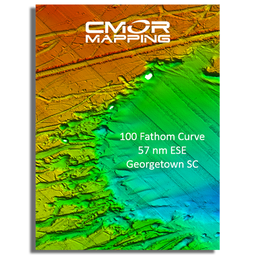
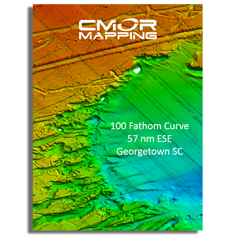
- 100 Fathom Curve (57nm ESE of Georgetown SC)
- Charleston Bump and many surrounding areas (swordfish mecca)
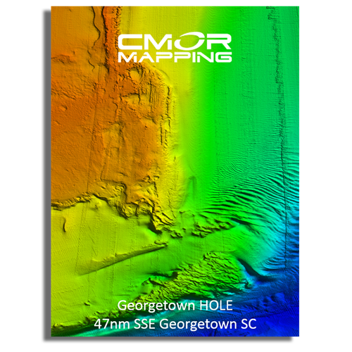
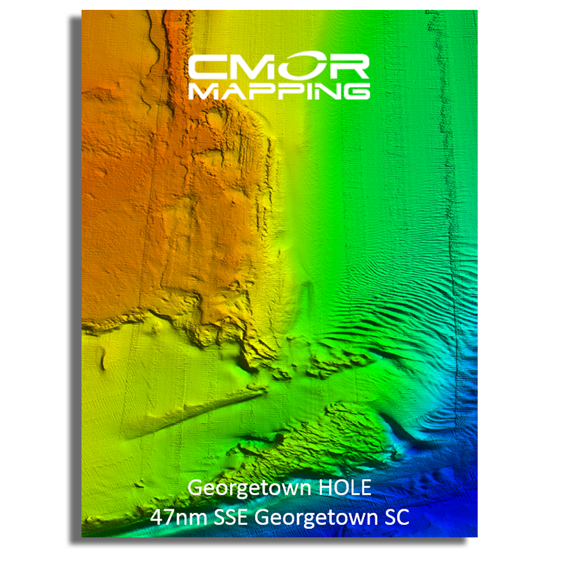
- Georgetown Hole (47nm SSE Georgetown SC)
- 100 / 400 area (59nm SE Little River Inlet, SC)
- Winyah Scarp (43nm SE Georgetown SC)
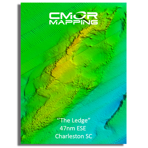
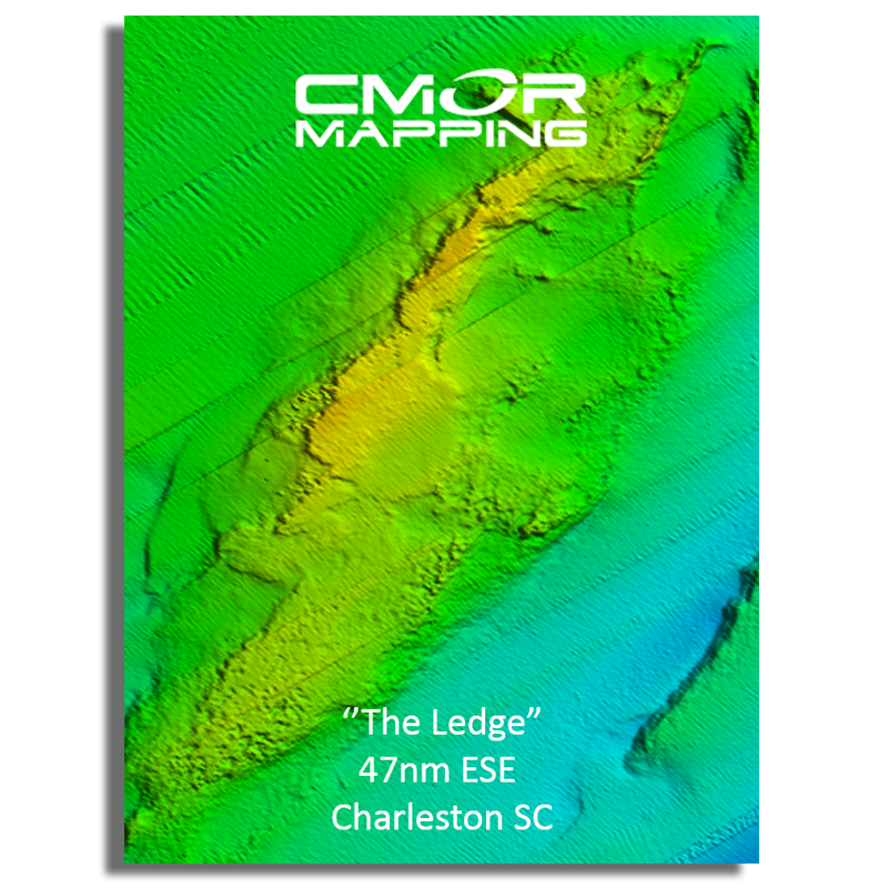
- “THE LEDGE” (47nm ESE Charleston SC)
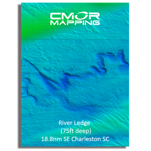
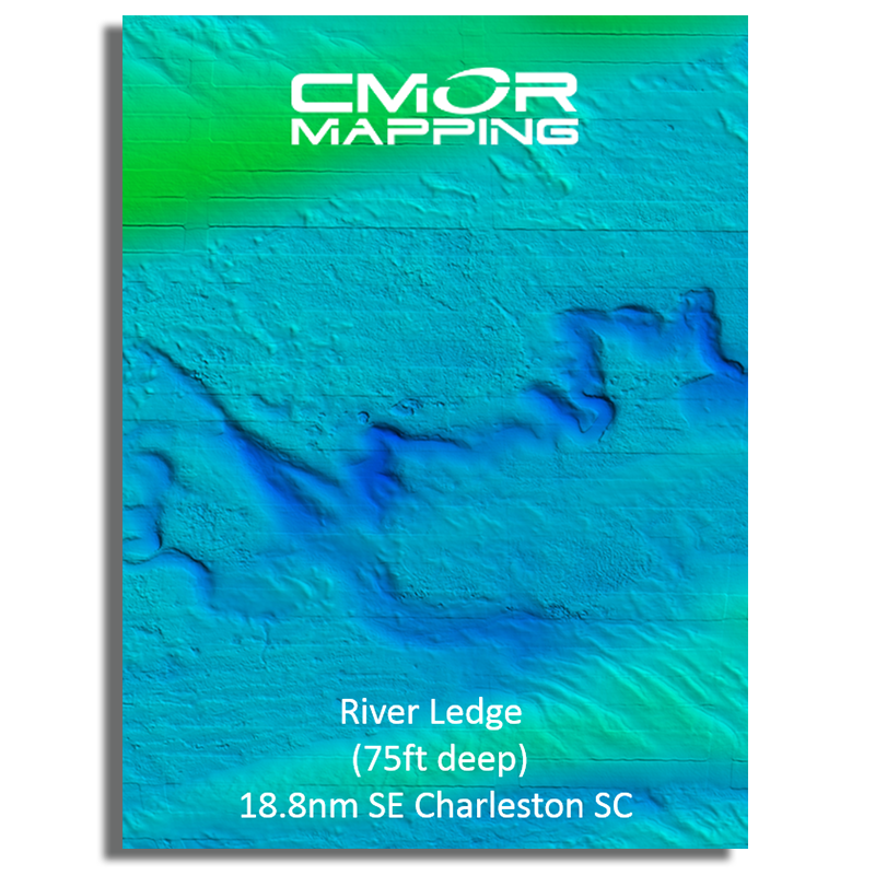
- River Ledge 75ft depth (18.8nm SE Charleston SC)
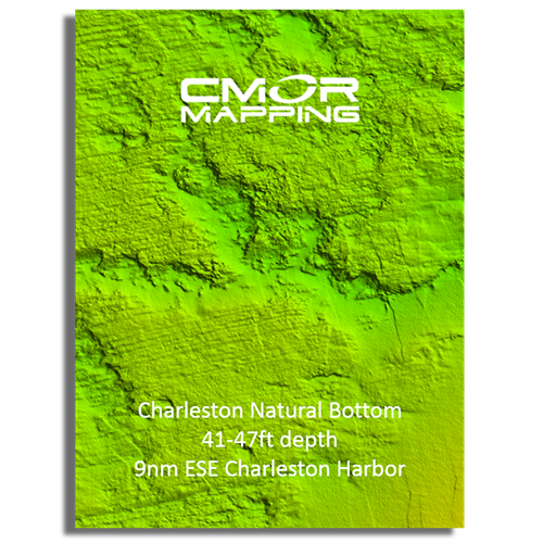
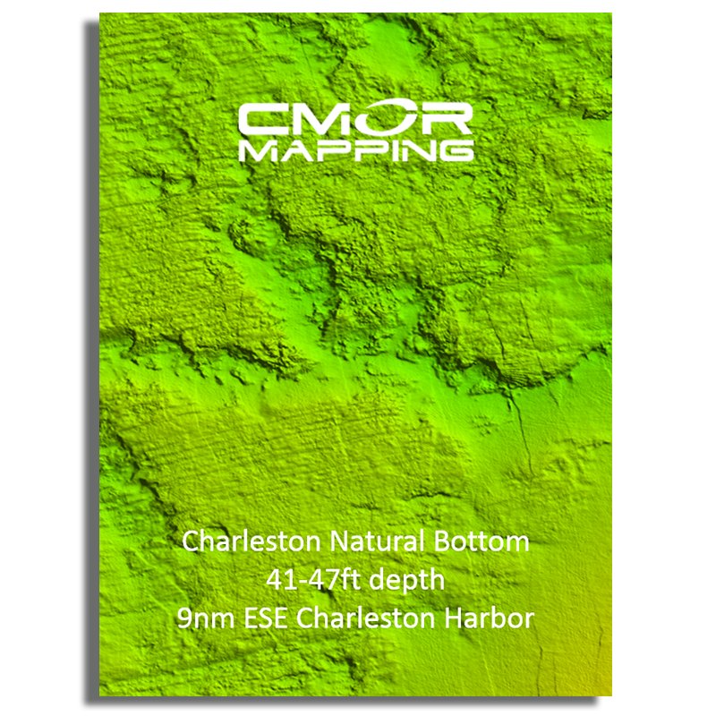
- Charleston Natural Bottom 41-47ft depth (9nm SE Charleston Harbor)
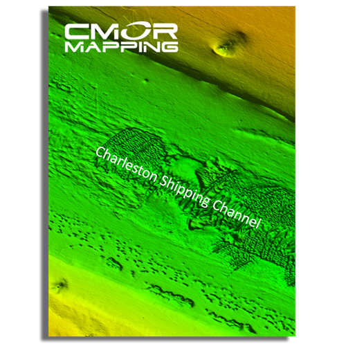
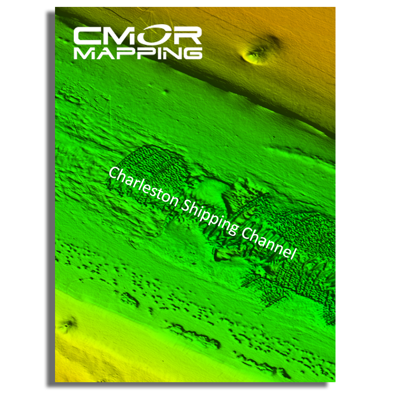
- Charleston Shipping Channel
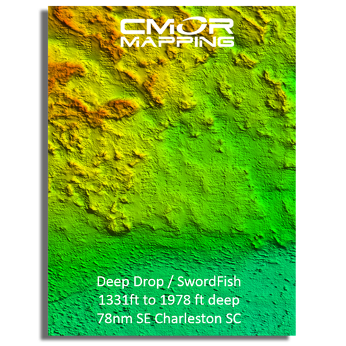
- Deep Drop / Swordfish Bottom 1331 to 1978ft 78nm SE Charleston SC
- Edisto Banks (50nm SE Edisto Island, SC)
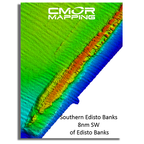
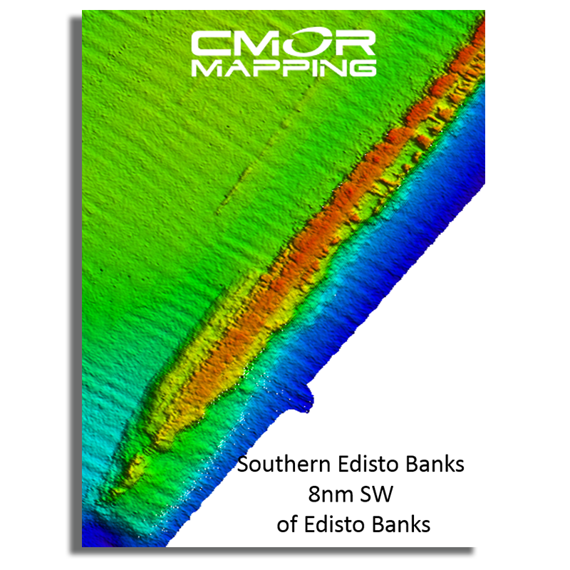
- Southern Edisto Banks (8nm SW of Edisto Banks)
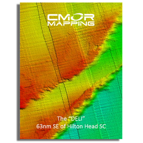
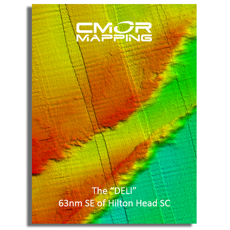
- The “DELI” (63nm SE of Hilton Head Island)
- Triple Ledge (66nm SE Savannah Georgia )
- Grays Reef Ledge 50-60ft depth (18nm SE Sapelo Sound GA)
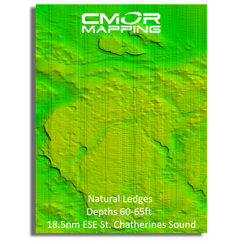
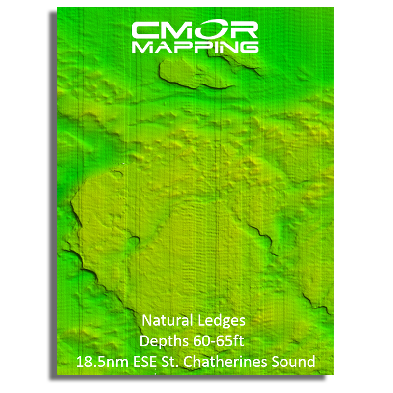
- Natural Ledges Depths 60-65ft (18.5nm ESE St. Chatherines Sound)
- Anchor Ledge 75-82ft depth (26nm SE Ossabaw Sound)
- “GROUPER” ledges 120-128ft Depth (49nm East St. Simons)
- “KBY” Artificial Reef (9nm ENE Fernandina Beach, FL)
- SCAMP CITY 140-148ft depth (64nm East St. Mary's River)
- “FB” Natural Ledges (14nm ESE Fernandina Beach FL)
- Nassau Mud Humps (6nm E Nassau Sound)
- Jax Live Bottom 81-86ft deep (17nm E St. Johns River)
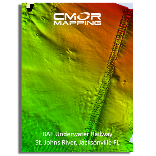
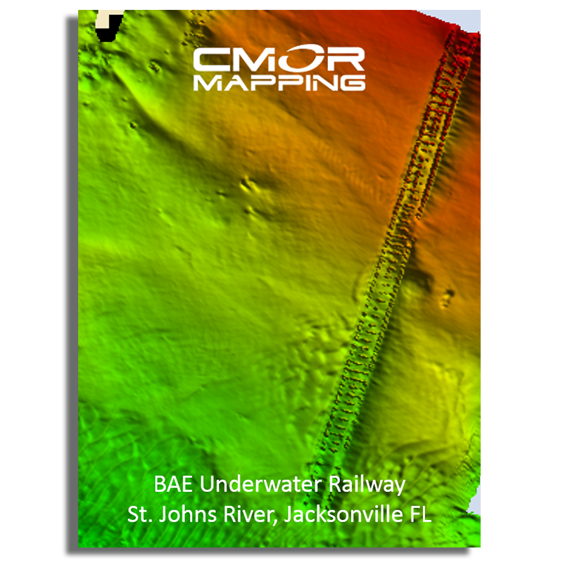
- Mayport Jetties and St. Johns River
- Pinnacles 1450 ft sand – 1351 ft top (43nm E Cape Canaveral)
This CMOR chart is compatible with all NavNet TZtouchXL, TZtouch3, and NavNet TZtouch2 MFDs with software version 6.23 and above. To purchase this chart pack for NavNet, you will need to provide your NavNet system ID to your local authorized Furuno dealer. The system ID can be located under the MyNavNet menu on your NavNet system.
Click here to download CMOR Mapping - North Florida, Georgia, and South Carolina.
Note that you will need to purchase an unlock code from CMOR at the contact information provided at the top of this page.
NOTE: All sales of Chart Unlock Codes are final. Once an unlock code for any chart area is purchased and the code has been provided by Furuno, no refunds, credits, or exchanges are permitted.
Areas displayed are for guidance only and do not reflect exact coverage.