
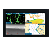
 NavNet MFDs
 Radars
 Fish Finders & Transducers
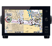 GPS & Chart Plotters
 Autopilots
 Navigation
 Sonars
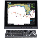 Commercial
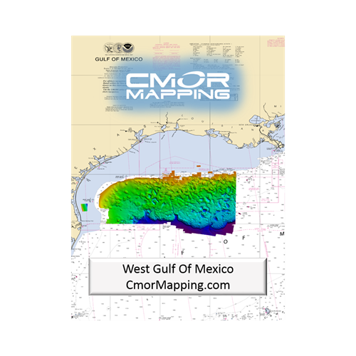
MM3-WAR-BAT-04
MSRP: $700.00
CMOR Mapping for NavNet TZtouch2 and TZtouch3 - West Gulf of Mexico
Chart RegionsUSA Central or USA
Chart TypeCMOR
Prices and Specifications Subject to Change Without Notice.
All prices shown are in USD. Prices are valid in US and Canada only.
Available exclusively from CMOR Mapping
CMOR Charts can be purchased only through CMOR. Visit them on the web at www.cmormapping.com.
Phone: 813-563-2667 (option 1 for sales)
E-Mail: sales@cmormapping.com
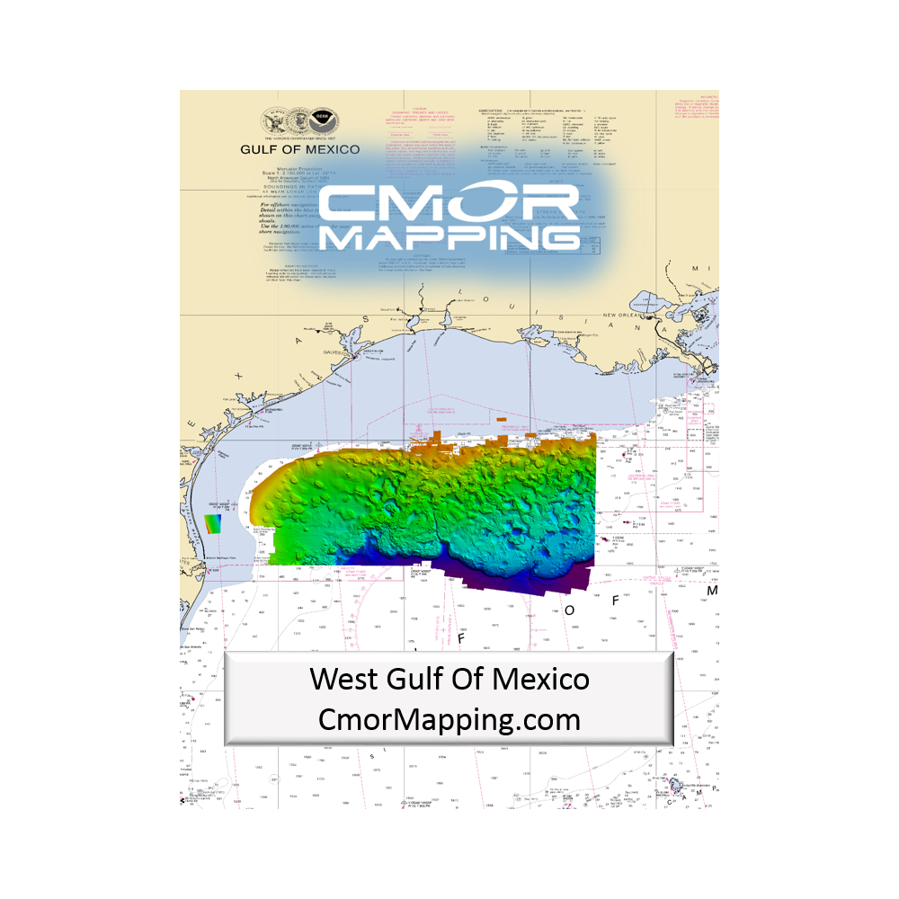
CMOR Mapping - West Gulf of Mexico
The CMOR Mapping West Gulf of Mexico 3D shaded relief chart extends from the South Texas border through Caillou Bay (West Louisiana). This massive update includes new nearshore, mid drop, and deep drop throughout the chart, as well as coverage for Galveston Bay.
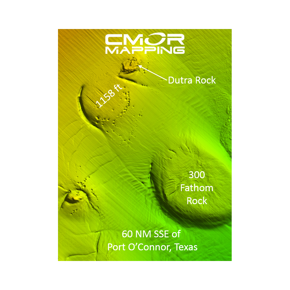
CMOR Mapping West Gulf of Mexico chart offers depth ranges from 5’ to over 12,000’ deep beyond the canyons and features a significant expansion of natural bottom and wrecks as well as new fishing hotspots containing unbeatable coverage and resolution for targeting everything from nearshore snapper to pelagics, and daytime swordfish.
Feature spots include:
- Deep water coverage from approximately 250’- 12,000’ throughout the West Gulf of Mexico
- 270 square-mile nearshore area offshore of Laguna Madre
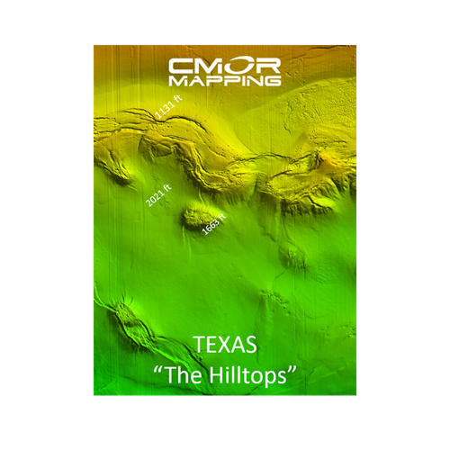
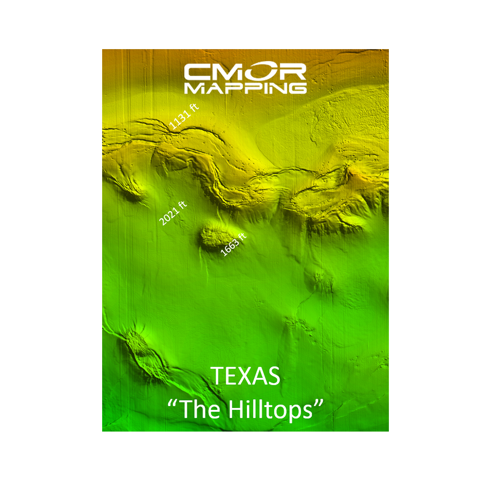
- The Texas “Hilltops”
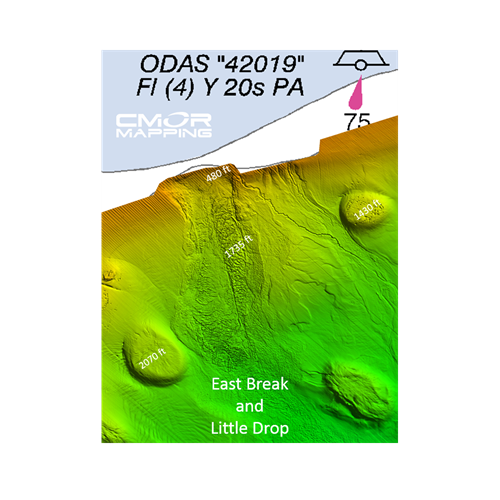
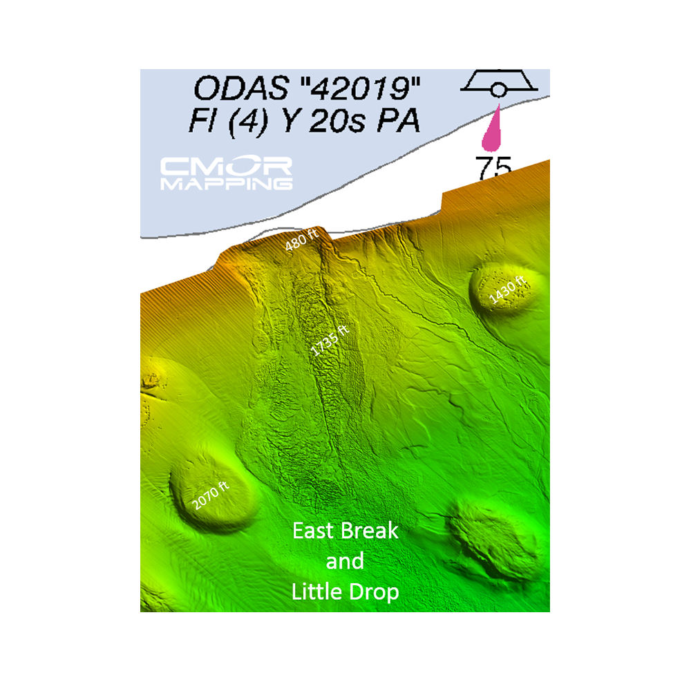
- East Break and Little Drop
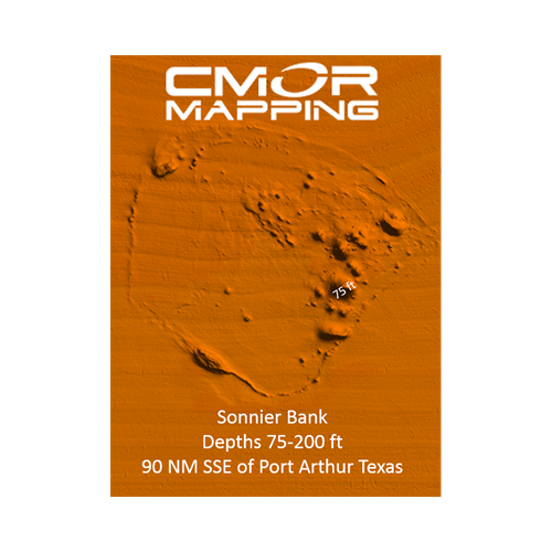
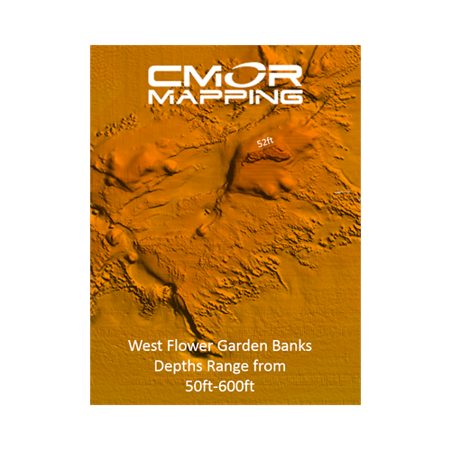
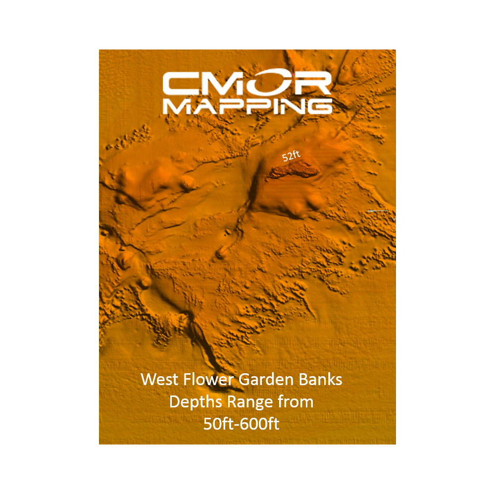
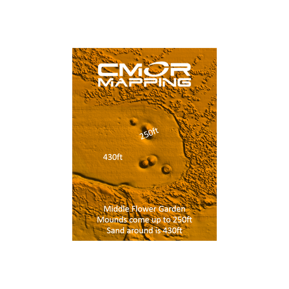
- West Flower Garden Banks
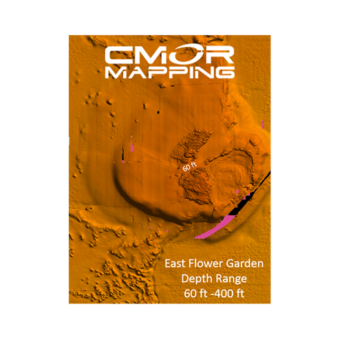
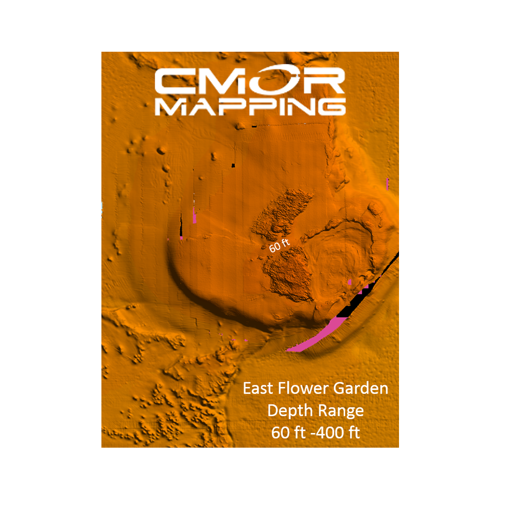
- East Flower Garden Banks
- Galveston Bay
- Hopper Barge
- Matagorda Ships
- Mustang Island
- North Padre Island
- Lonestar Reef
- The Kraken
Shelf Banks and Domes:
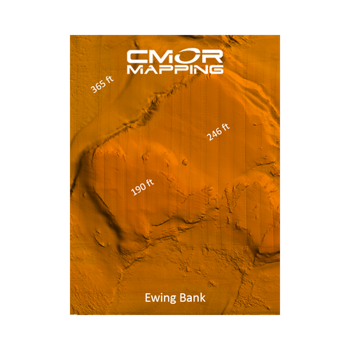
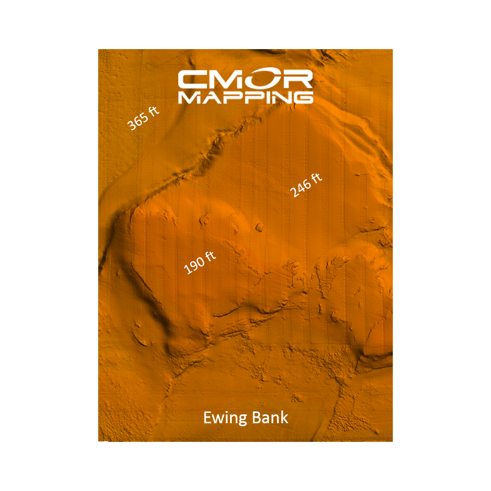
- Ewing Bank
- Adeline Bank
- Patterson Bank
- Berwick Bank
- Alaminos Bank
- Verdunville Bank
- Jackula Bank
- Alderdice Bank
- Sweet Bank
- Pheger Bank
- Musogee Bank
- Tresslar Bank
- Sidner Bank
- Rezak Bank
- Bryant Bank
- Bouma Bank
- McGrail Bank
- Elvers Bank
- Geyer Bank
- Beight Bank
- Geyer Bank
- Bright Bank
- Ramkin Bank
- MacNeil Bank
- Alamo Bank
- Calhoun Dome
- Mansfield Dome
- Price Spur
- Nueces Dome
- Kleberg Dome
- Willacy Dome
- Appelbaum Bank
- Most deep water Basins, Ridges, escarpments, and Domes in the Western Gulf
This CMOR chart is compatible with all NavNet TZtouchXL, TZtouch3, and TZtouch2 MFDs with software version 6.23 and above. To purchase this chart pack for NavNet, you will need to provide your NavNet system ID to your local authorized Furuno dealer. The system ID can be located under the MyNavNet menu on your NavNet system.
Click here to download CMOR Mapping - West Gulf of Mexico.
Note that you will need to purchase an unlock code from CMOR at the contact information provided at the top of this page.
NOTE: All sales of Chart Unlock Codes are final. Once an unlock code for any chart area is purchased and the code has been provided by Furuno, no refunds, credits, or exchanges are permitted.
Areas displayed are for guidance only and do not reflect exact coverage.