
 Multi Function Displays
 Radars
 Fish Finders & Transducers
 GPS & Chart Plotters
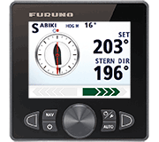 Autopilots
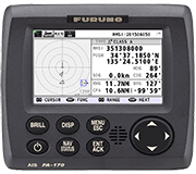 Navigation
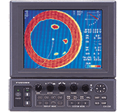 Sonars
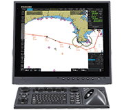 Commercial
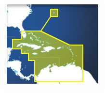
MM3-V90-8G0
No Longer Available
MSRP: $250.00
Bahamas/Caribbean/Bermuda: Vector charts, 3D data and standard resolution satellite photos
Chart RegionsBahamas or USA East Coast or Caribbean or USA
Chart TypeVector or Navionics Datacore or 3D Bathy Data or Satellite Photo
Prices and Specifications Subject to Change Without Notice.
All prices shown are in USD. Prices are valid in US and Canada only.
Vector Charts, 3D Data and Standard Resolution Satellite Photos - Bahamas/Caribbean/Bermuda
The Bahamas/Caribbean/Bermuda Chart Pack includes vector charts, 3D data and standard resolution satellite photography for the southern tip of Florida, Caribbean & Bermuda, Bahamas, Cuba, Haiti, Jamaica, Dominican Republic, Grenada, North Columbia, Guyana, Bahamas, South Florida, From Fort Pierce to Fort Myers in Florida including the Cayman Islands, Puerto Rico, Lesser Antilles, Windward Islands, Boca Grande, Trinidad, Golfo de Uraba, Aruba and Curacao. The vector charts datacore is by Navionics and then converted to the TimeZero format.
To purchase this chart pack for NavNet, you will need to provide your NavNet system ID to your local authorized Furuno dealer. The system ID can be located under the MyNavNet menu on your NavNet system.
Click here to download chart from MapMedia.com. Note that you will need to purchase an unlock code from your Authorized Furuno Dealer.
NOTE: While this chart pack includes "Standard Resolution" satellite photos, it no longer includes "High Resolution" satellite photos. The "High Resolution" satellite photos can now be found at MM3-908-SAT. Note that you will need to purchase an unlock code from your Authorized Furuno Dealer.
NOTE: All sales of Chart Unlock Codes are final. Once an unlock code for any chart area is purchased and the code has been provided by Furuno, no refunds, credits, or exchanges are permitted.
Areas displayed are for guidance only and do not reflect exact coverage.
Bahamas/Caribbean/Bermuda: Vector charts, 3D data and standard resolution satellite photos
The Bahamas/Caribbean/Bermuda Chart Pack includes vector charts, 3D data and standard resolution satellite photography for the southern tip of Florida, Caribbean & Bermuda, Bahamas, Cuba, Haiti, Jamaica, Dominican Republic, Grenada, North Columbia, Guyana, Bahamas, South Florida, From Fort Pierce to Fort Myers in Florida including the Cayman Islands, Puerto Rico, Lesser Antilles, Windward Islands, Boca Grande, Trinidad, Golfo de Uraba, Aruba and Curacao. The vector charts datacore is by Navionics and then converted to the TimeZero format.
To purchase this chart pack for NavNet, you will need to provide your NavNet system ID to your local authorized Furuno dealer. The system ID can be located under the MyNavNet menu on your NavNet system.
Click here to download chart from MapMedia.com. Note that you will need to purchase an unlock code from your Authorized Furuno Dealer.
NOTE: While this chart pack includes "Standard Resolution" satellite photos, it no longer includes "High Resolution" satellite photos. The "High Resolution" satellite photos can now be found at MM3-908-SAT. Note that you will need to purchase an unlock code from your Authorized Furuno Dealer.
NOTE: All sales of Chart Unlock Codes are final. Once an unlock code for any chart area is purchased and the code has been provided by Furuno, no refunds, credits, or exchanges are permitted.
Areas displayed are for guidance only and do not reflect exact coverage.